Zawoja, Babia Góra
Compass
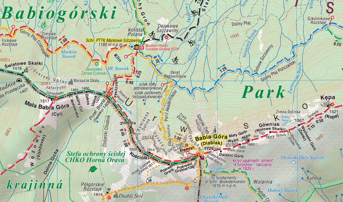
The map shows the eastern part of the Beskid Żywiecki with the Babia Góra National Park. The range of the map is marked by: Stryszawa in the north, Magurka (1'114 m asl) in the west, Kiczory in the south and Zubrzyca Górna in the east.
Babia Góra (1'725 m asl) has attracted the attention of travellers and researchers alike, and fascinated writers and poets for centuries. Not without a reason the mountain top was called Diablak, it was said that evil powers had its headquarters there. Among all Polish mountains, Babia Góra is second only to the peaks of the Tatra Mountains in terms of height. Its characteristic feature is the asymmetry of its slopes: the southern slopes descending towards Orava are relatively gentle in relation to the steep and precipitous northern slopes, clearly visible from Zawoja, which are referred to as the 'great break of Babia Góra'. At the northern foot of Babia Góra there is Zawoja, the largest village in Poland in terms of area. It is an attractive holiday resort and an ideal base for exploring the Babia Góra Range. On the map, shading was applied in order to obtain a more impressive image of the terrain. The offline map can be purchased in the Traseo application for mobile devices. Year of publication 2021
Country
Poland
Scale
1:30 000
Buy this map using free mobile app
 Traseo. Off-line Maps & Trails