Pădurea Craiului Mountains
Pădurea Craiului | Király-erdő-hegység
Dimap
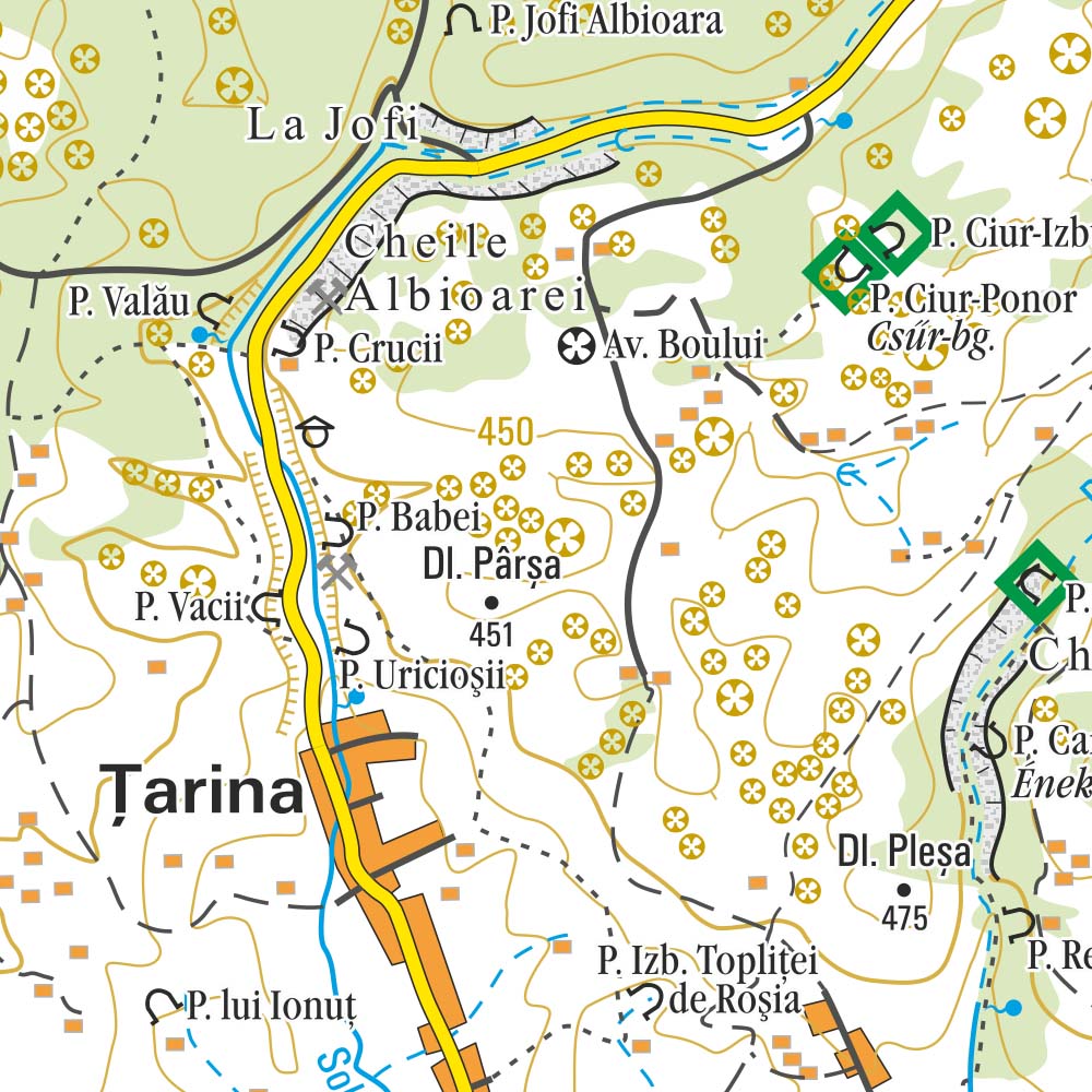
The Pădurea Craiului Mountains are in the northwestern part of the Apuseni Mountains of the Carpathian Mountain range, located between the Vad-Borod Depression and Beiuş Depression. The Dealurile Vestice (Western Hills) are located to the west of these mountains and the Vlădeasa Mountains are to their east. The highest peak in Pădurea Craiului is Hodrâncuşa at 1027 metres. The name Pădurea Craiului literally means "The Forest of the King". (wikipedia.com)
Attention! There is a little calibration mistake on the map - e.g. 200 m relative to google maps.
Country
Romania
Scale
1:50 000
Buy this map using free mobile app
 Traseo. Off-line Maps & Trails


No results